RhinoLands
BIM Standalone Solution for Landscape Design
2D • 3D • Documentation • Visualization
How is RhinoLands used?
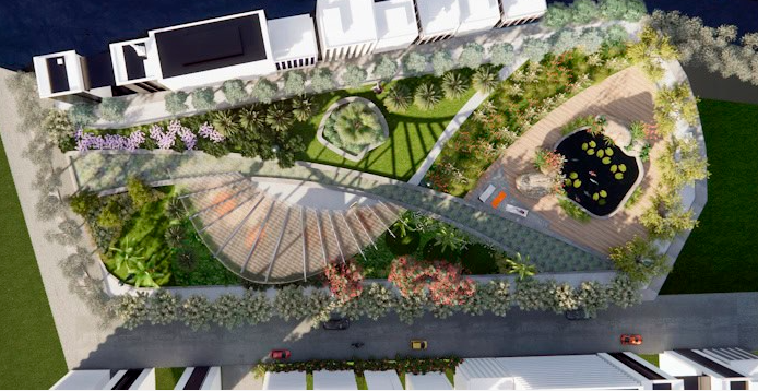
Landscape Architecture
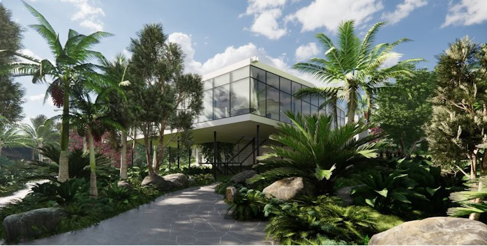
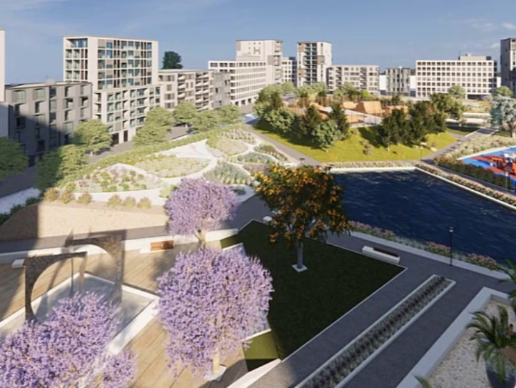
Landscape design projects in different scales and sectors can be easily provided by RhinoLands. It’s your powerful tool in the design process for generating 2D layouts, 3D models and realistic images and videos.
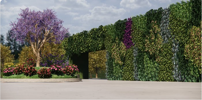
Green Infrastructure
Natural areas can act as an infrastructure, protecting the built environment from pollutions, water flooding or excessive heat. RhinoLands gives you the power to add vertical gardens, green roofs and green areas to your architectural and civil engineering projects.
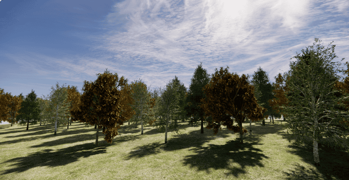
Forestry
The powerful terrain, forest and irrigation tools accompanied with hardscape tools, can be used in design process and modeling of forests in silviculture sector. BIM technology visualizes seasonal change and annual growth of plants.
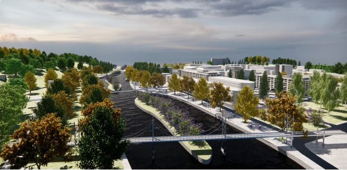
Urban Planning
Urban vegetation plays a key role in improving the quality of the built environment. In introducing plants as essential natural elements in urban planning projects, RhinoLands helps you to design public spaces, joint with green areas, lets you choose the adequate plant selection and visualize the urban area in different seasons.
CG Artists
RhinoLands can be applied for generating an environment for computer graphics (CG) artists. You can create 2D and 3D game assets to be used in developing video games, 3D visualization, and digitally animated films.
Why use RhinoLands
Maximize Your Project with BIM/LIM
Experience intelligent elements like vegetation, hardscape, and terrains for effortless editing and meticulous documentation, streamlining quantity assessments.
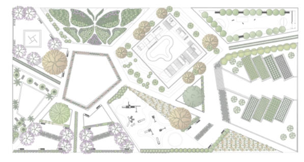
RhinoLands generates linked 2D technical drawings, tightly integrated with the 3D model and accompanying documentation. Unleash the potential of RhinoLands for superior project management.
Dynamic 2D Documentation:
Effortlessly turn 2D sketches into 3D projects. Generate precise technical plans from your 3D model, adding dimensions, labels, and annotations. Organize your project with the layer manager and produce various layouts. Use listing tools for quick quantity take-offs. RhinoLands simplifies your documentation process.
Bring Your Project to Life:
Immerse your audience with realistic images, virtual tours, and animated videos. Showcase your project in stunning detail—walkthrough, simulate vegetation changes, and animate sunlight.
In addition to Rhino render, you can integrate your preferred render engine for breathtaking visual presentations, such as Enscape, Lumion, V-Ray, Twinmotion, and more. RhinoLands transforms your project experience.
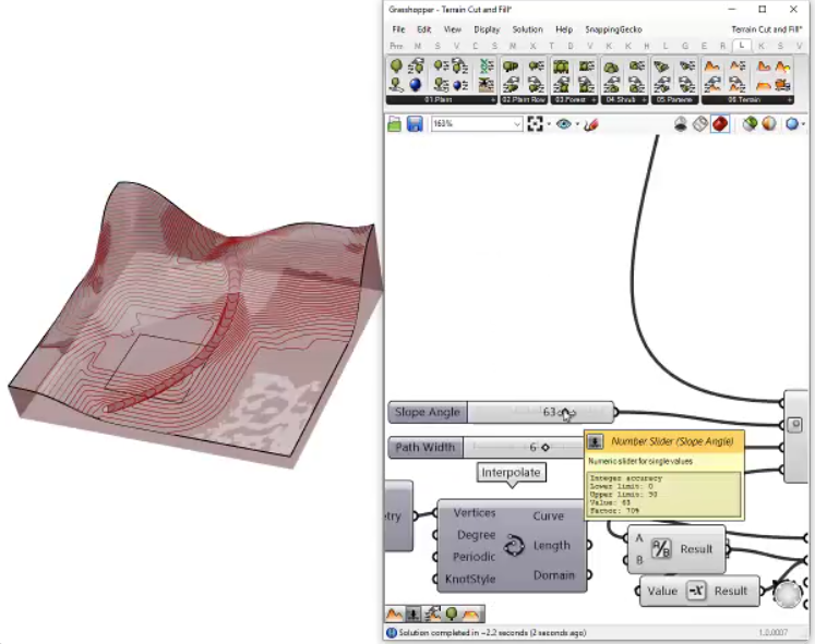
Dynamic Terrain and Grading Tools
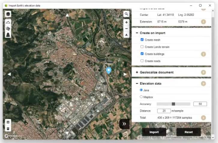
Craft 3D terrains and perform precise grading tasks using RhinoLands. Generate terrains from topographic contours, meshes, and point clouds, or import them from satellite maps.
Refine terrains by adding cuts, fills, paths, and holes, and effortlessly calculate area and volume movements. With RhinoLands, manipulate terrain and grading with ease, ensuring optimal project precision.
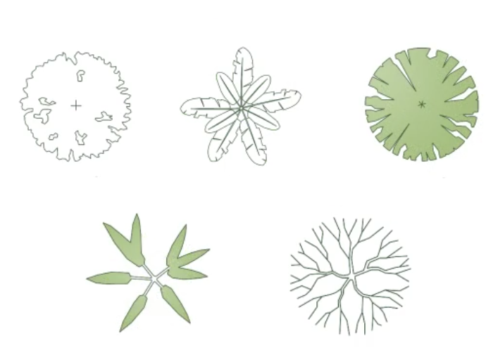
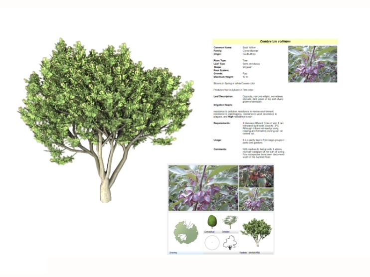
Extensive Plant Database in 3D/2D:
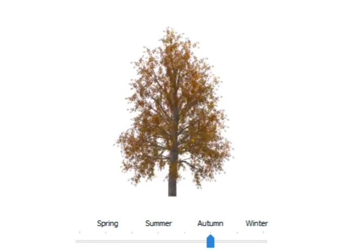
Access over 8000 plant species in our comprehensive database. Easily find the perfect fit for your site by filtering based on criteria such as climate, soil type, wind resistance, and flowering characteristics. Each plant species offers customizable 2D and 3D display modes, ready for rendering, plan exporting, and season/growth simulation.
Enhance Your Design Workflow with Parametric Design:
Automate tasks for vegetation, terrains, and civil elements, saving time and offering custom functionalities. Utilize Grasshopper, fully integrated into RhinoLands, for swift testing of various design options.
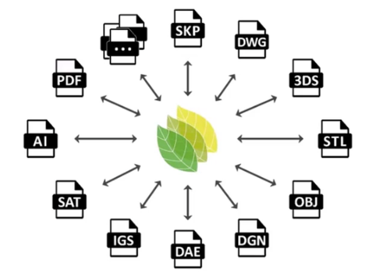
Improved Interoperability:
Import and export files effortlessly across platforms with RhinoLands’ support for various formats. Integrate web block libraries with ease. Transition your project into virtual reality, prepare for 3D printing or export for web browsers. Experience versatile sharing options.
RhinoLands is standalone software.
Lands Design (as a plugin) is Available for Rhino, AutoCAD and Civil 3D
Lands Design works on top of Rhino and AutoCAD / Civil 3D and takes advantage of all their features to complete all stages of a landscape project.

© Copyright 2000-2025 COGITO SOFTWARE CO.,LTD. All rights reserved
