Chesapeake Case study--TEACHING SEAFLOOR MAPPING WITH SONARWIZ
Dr Tim Scott Lecturer in Ocean Exploration, Plymouth University
In the first year of their studies at Plymouth University, Marine Science undergraduate students are immersed in all aspects of marine science and hydrography, from basic theory in the classroom to research, data collection and analysis in the field and lab. The aim is to provide a complete experience where they gain industry relevant competencies, experience in fieldwork planning and data collection, and develop new skills in data processing and scientific data analysis. They will then take forward and develop these skills further in more specialized studies in subsequent years (Ocean Exploration, Coastal Processes, Oceanography and Marine Conservation).
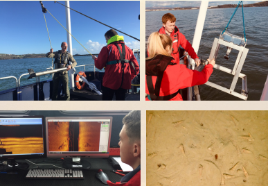
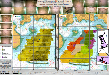
As part of this introductory process we run an intensive module where students are introduced to marine acoustic theory and go on to map and classify the sedimentary characteristics of Plymouth Sound (Devon, UK). The survey spread includes a GeoAcoustics PULSAR sidescan sonar with SonarWiz 7 software for acoustic backscatter data acquisition, supported by seabed ground truthing using drop camera video. After 10 days of data collection in multiple groups, the students achieve full survey coverage of the central region of the Sound and >30 drop camera casts. They then go on to process their sonar data and produce a geo-referenced mosaics for further analysis in GIS software.
From our experience SonarWiz 7 provides a fantastic teaching tool that is robust, intuitive and provides a one-stop shop from acquisition to mosaic; enabling students to experience a full-cycle survey project in their first 6 months of study.

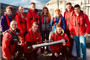
Student field team with techanical support from Adam Bolton returning from the field with GeoAcoustics PULSAR

Sonar deployment and sediment drop camera video cast in Plymouth Sound. Onboard data acqusition, QC and line running with SonarWiz 7.

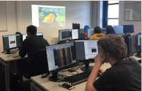
Post-processing in specialist hydrographic computing suite.

Example of final maps generated by the students. Their fisrt seafloor mapping experience!
© Copyright 2000-2025 COGITO SOFTWARE CO.,LTD. All rights reserved