Guthrie Arcv2CAD 8
AutoCAD 2019 and EPSG coordinate system support!
Arcv2CAD converts all ESRI ArcGIS® 2D/3D Shapefile (Multipatch, Polygon, Point, Polyline etc.) to AutoCAD® DXF, DWG or KML quickly and easily. Completely stand-alone (does not require ArcGIS® or AutoCAD). Batch conversion and layer control are available.
• No registration required to download and convert.
• Convert Text Labels, Legends, Table data, Elevation data, colors and layers from Shapefile to AutoCAD® DXF, DWG or KML. (Support Shapefile to KML conversion.)
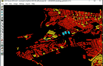
• Convert multipatch and 2D/3D polygon to 3D objects in AutoCAD.
• Select Shapefile feature attributes to convert to DWG, DXF or KML.
How to convert SHP to DWG (or SHP to DXF):
Step 1: Select a Shapefile.
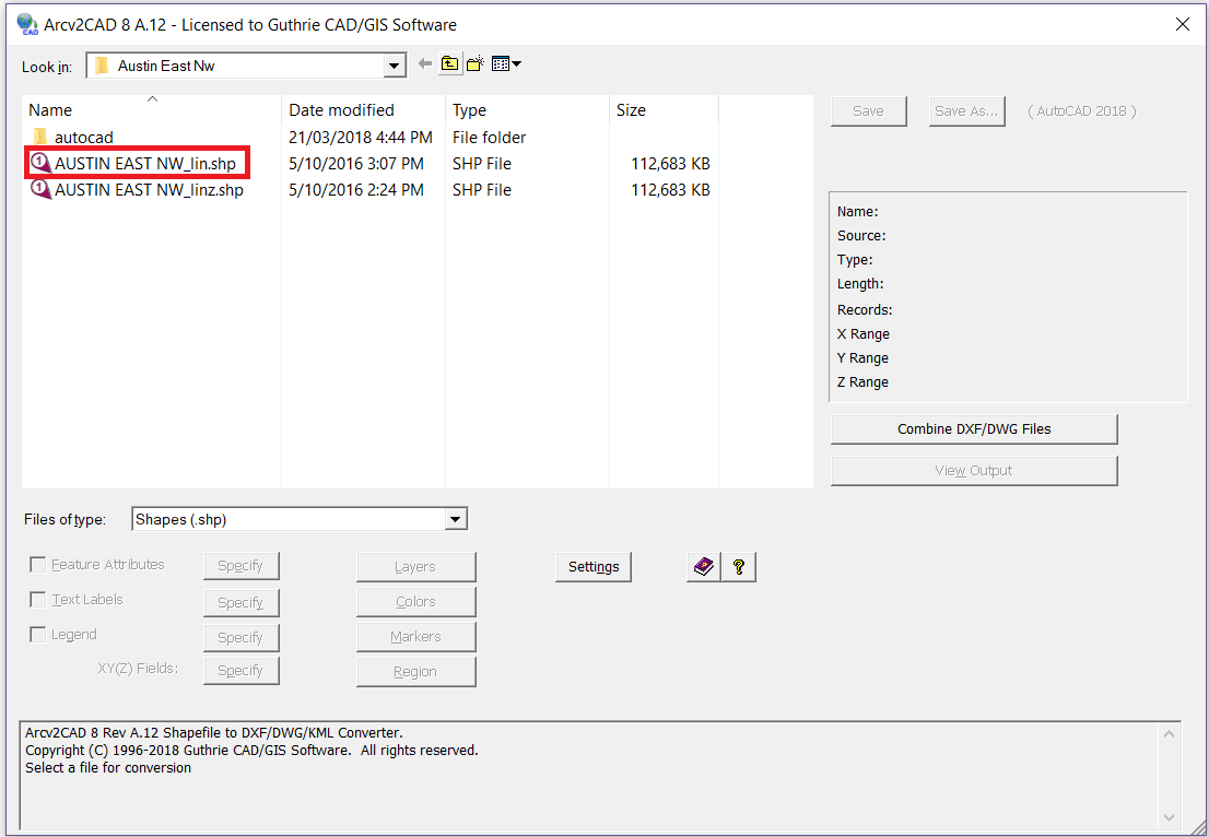
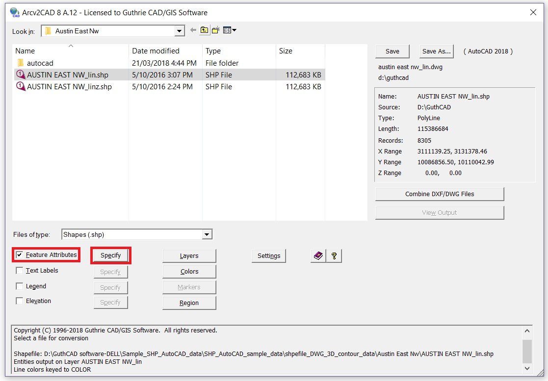
Step 2: If necessary, also select Features Attributes, Text Labels or Elevation. Press Specify button.
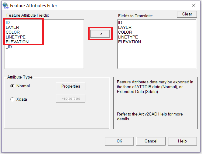
Step 3: Select Feature Attribute Fields that you want to convert. Then press "-->" button and OK button.
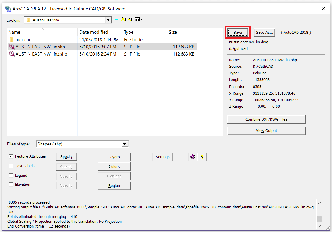
Step 4: Press Save button. Then Arcv2CAD converts the shapefile to a DWG file.
Software Overview:
CLICK TO ENLARGE ARCV2CAD SOFTWARE SCREENSHOT IMAGES
Extrude 2D polygon shapefile to AutoCAD 3D objects
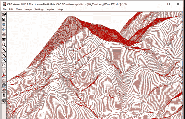
Convert elevation [contour] data as real 3D Z coordinates
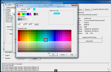
Apply Colors corresponding to selected Feature Attributes and convert to AutoCAD text annotations.
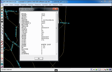
Transfer table data via DXF/DWG ATTRIB or Extended Data (XData) definitions.
YOU CAN EASILY KEEP ATTRIBUTES WHEN CONVERTING ESRI ARCGIS SHAPEFILE TO DXF/DWG.
You just need to tick "Features Attributes", press Specify button and select attributes you want to convert to DXF/DWG.
OS: Win 2003/2008/2012/Citrix/XP/Vista/Win7/win7x64/Win8/Win8x64/Win10
Your Feature Complete Solution!
CONVERSIONS:
• Translate to AutoCAD DXF and DWG versions up to AutoCAD 2018-2019.
• Optionally output to CSV.
• Command line mode for batch operation.
HANDLING FEATURE ATTRIBUTES:
• Apply Colors corresponding to selected Feature Attributes.
• Output AutoCAD entities onto Layers corresponding to Feature Attributes.
• Produce Text Labels from Features data. Powerful built in Auto-Label function.
• Transfer table data via DXF/DWG ATTRIB or Extended Data (XData) definitions.
LAYER AND PROPERTIES CONTROL:
• Properties control for attributes (ATTRIBs), i.e. size, position, color, etc.
• Layer control - The Layers Control dialog allows you to determine LAYER names, and the entities that will be placed on such Layers.
3D SHAPEFILE TYPE:
• Support for all 3D shapefile types (PointZ, PolylineZ, PolyGonZ, MultiPatch, etc).
• Fully handles the latest 3D shapefiles.
HANDLING POLYGON SHAPEFILE:
• Extrude 2D Polygon shapes to 3D Objects in DWG/DXF.
• Color fill Polygons - correctly handles holes.
DATA SOURCE:
• Compatible with all ESRI ArcGIS® / ArcMap®/ ArcView® / ... products (all versions.).
• Support direct access to shapefiles in ESRI Personal Geodatabase (.mdb) files.operation.
• Data source may be CSV or DBF (i.e. no shapefile, simply a points database).
HANDLING ELEVATION DATA (Z VALUES):
• Output Elevation data as real 3D Z coordinates.
• Create elevation labels from point Z shapefile's Z values.